


Voting District 060009, Albany County, New York
About
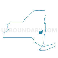
Outline

Summary
| Unique Area Identifier | 624517 |
| Name | Voting District 060009 |
| County | Albany County |
| State | New York |
| Area (square miles) | 1.48 |
| Land Area (square miles) | 1.46 |
| Water Area (square miles) | 0.02 |
| % of Land Area | 98.85 |
| % of Water Area | 1.15 |
| Latitude of the Internal Point | 42.75743760 |
| Longtitude of the Internal Point | -73.71597860 |
Maps


Graphs
Select a template below for downloading or customizing gragh for Voting District 060009, Albany County, New York


Neighbors
Neighoring Voting District (by Name) Neighboring Voting District on the Map
- Voting District 050303, Albany County, NY
- Voting District 050305, Albany County, NY
- Voting District 060010, Albany County, NY
- Voting District 060017, Albany County, NY
- Voting District 060018, Albany County, NY
- Voting District 060019, Albany County, NY
- Voting District 070001, Albany County, NY
- Voting District 070002, Albany County, NY
- Voting District 070004, Albany County, NY
- Voting District 120302, Albany County, NY
- Voting District 120303, Albany County, NY
Top 10 Neighboring County Subdivision (by Population) Neighboring County Subdivision on the Map
- Colonie town, Albany County, NY (81,591)
- Cohoes city, Albany County, NY (16,168)
- Watervliet city, Albany County, NY (10,254)
- Green Island town, Albany County, NY (2,620)
Top 10 Neighboring Place (by Population) Neighboring Place on the Map
Top 10 Neighboring Unified School District (by Population) Neighboring Unified School District on the Map
- North Colonie Central School District, NY (39,534)
- Cohoes City School District, NY (16,168)
- Watervliet City School District, NY (11,009)
- Green Island Union Free School District, NY (2,616)
Top 10 Neighboring State Legislative District Lower Chamber (by Population) Neighboring State Legislative District Lower Chamber on the Map
Top 10 Neighboring State Legislative District Upper Chamber (by Population) Neighboring State Legislative District Upper Chamber on the Map
Top 10 Neighboring 111th Congressional District (by Population) Neighboring 111th Congressional District on the Map
Top 10 Neighboring Census Tract (by Population) Neighboring Census Tract on the Map
- Census Tract 130, Albany County, NY (6,545)
- Census Tract 135.06, Albany County, NY (6,361)
- Census Tract 133, Albany County, NY (4,427)
- Census Tract 135.03, Albany County, NY (4,277)
- Census Tract 128, Albany County, NY (3,836)
- Census Tract 132, Albany County, NY (3,397)
- Census Tract 131, Albany County, NY (2,620)